After a late afternoon and evening rest from my photography workshop, Kathryn and I had a relaxing wander around Reykjavik.
We were staying at the Reykjavik Saga hotel which despite its name is not an old person’s Saga holiday establishment, but it turns out Saga is a brand. This didn’t prevent a wisecrack from my fellow photographers when I got dropped off.
Day 1 – Reykjavik and the Northern Lights
We decided to head towards the famous Reykjavik cathedral.
About Reykjavik
Reykjavík is the capital of, and largest city in Iceland. It is located in southwestern Iceland, on the southern shore of Faxaflói Bay.
With a latitude of 64°08′ N, the city is the world’s northernmost capital of a sovereign state. Reykjavík has a population of around 139,000 as of 2025.
The Capital Region has a population of around 249,000.
Walkabout
We wandered through the streets and up towards the cathedral.
You pass by Rainbow Street celebrating Pride and it calls out for a shot.
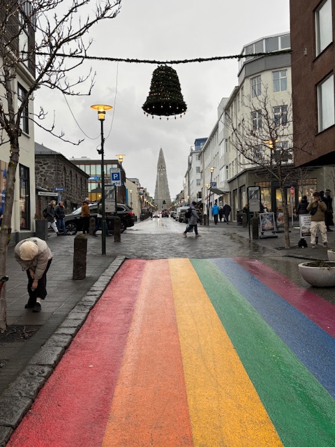
You can see the cathedral up ahead and that’s where we were heading.
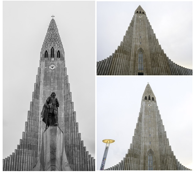
We were impressed as we approached the cathedral as it’s such an unusually shaped structure. It remind me of the space shuttle.
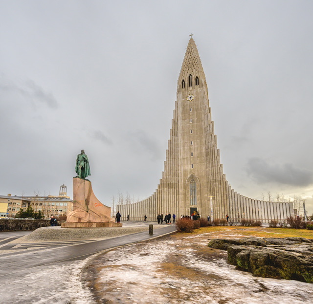
I could not resist taking some more images of this amazing structure, but obviously it was a case of trying to capture images without tourists.
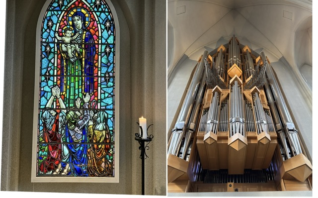
We went into the cathedral and had a look around inside.
We decided to cough up and pay to go up to the top of the cathedral to see the views across the city, and this was well worth the 1100 Krona (approx £6-7) each money.
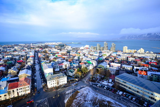
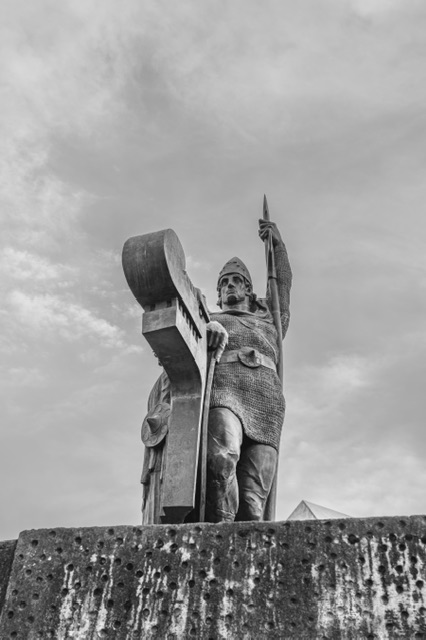
We left the cathedral and walked back down towards Rainbow Street and then right to stumble into a very interesting sculpture.
I had to improvise on composition as there was a tour guide and three tourists standing in the optimum spot to grab the best image. I didn’t like to interrupt them while they were in full lecture mode.
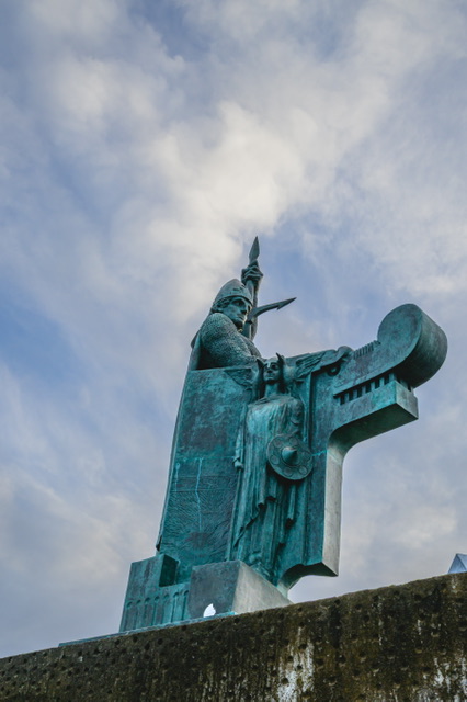
According to written records, the so-called Conquest of Iceland (between 870 and 930) began with
Ingólfur Arnarson , meaning the settlement of the previously almost deserted island by Vikings from
Norway and their Celtic slaves .
The Landnámabók ( The Book of Iceland ) reports this. According to archaeological excavations, Nordic “outposts,” seasonally inhabited places, existed as early as around 800.
We were of the view that we’d seen the main elements of Reykjavik and so headed back to our hotel.
We had our supper at the Hard Rock Café just a short stroll from our hotel and it was really good.
We got back to our hotel, changed into thermals and waited for the bus to see the Northern Lights.
Northern Lights Tour
The forecast looked pretty grim in terms of any hope of seeing the Aurora. On the photography trip, I had the luxury of seeing and capturing epic Aurora shots, but I really wanted Kathryn to see them.
We were keeping an eye on emails in case the trip was cancelled but it wasn’t and we hopped on the bus wondering what would emerge from the evening’s excursion.
The driver explained that we were heading to the South West peninsula where we would have the best chance of seeing the lights. He warned us that cloud and rain were a risk but he had high hopes of some visibility.
We travelled through Grindivik which was the abandoned town during the volcano eruption last year.
The driver was pointing out various things as we drove through but it was difficult to see things when it was so dark. But we did observe the weirdness of the town’s houses being empty, and the abandoned look albeit in the dark and with minimal street lighting, it was more of a glimpse.
We arrived at a natural spring location with a lighthouse and we were let out of the bus to observe and take pictures of the Aurora.
Below is one of my first shots.
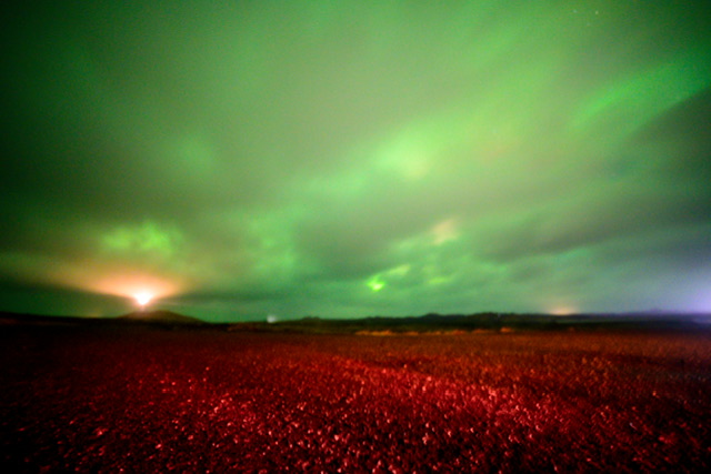
I had brought a small handheld tripod but it was so blustery that it would not stand up. So I had no choice but to attempt handheld shots.
On the other side of the bus, there were some concrete bollards and I quickly leaned on those to take a measured shot.
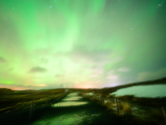
For handheld shots, these aren’t too bad, and Kathryn was thrilled to have witnessed the Aurora.
Day 2 – The Golden Circle
Thingvellir National Park
The first of three stops on the Northern Circle tour was Thingvellir.
About Thingvellir
Þingvellir (Icelandic: [ˈθiŋkˌvɛtlɪr̥], anglicised as Thingvellir was the site of the Alþing, the annual parliament of Iceland from the year 930 until the last session held at Þingvellir in 1798. Since 1881, the parliament has been located within Alþingishúsið in Reykjavík.
Þingvellir is now a national park in the municipality of Bláskógabyggð in southwestern Iceland, about 40 km (25 miles) northeast of Iceland’s capital, Reykjavík.
Þingvellir is a site of historical, cultural, and geological significance, and is one of the most popular tourist destinations in Iceland.
The park lies in a rift valley that marks the crest of the Mid-Atlantic Ridge and the boundary between the North American and Eurasian tectonic plates. To its south lies Þingvallavatn, the largest natural lake in Iceland
Our visit
As our coach approached the visitor car park, it was snowing. Nevertheless, our guide told us how long we had, hopped off and almost sprinted ahead.
We made our way to the first viewing platform behind the herd.
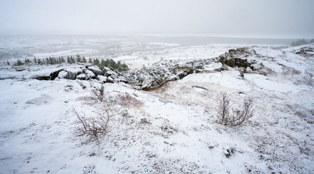
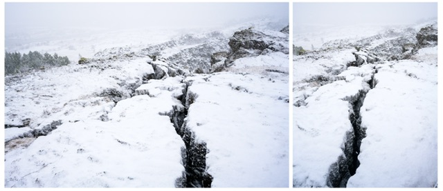
The next shot shows one of the cracks in the earth.
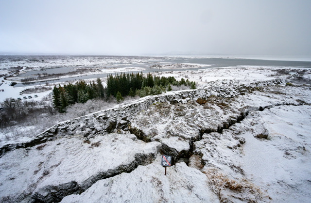
I took a shot to our left to capture the vast land around us and the rocky terrain.
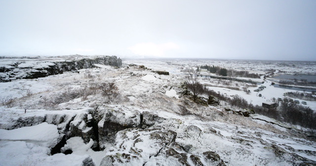
Walking around the fence overlooking this particular part of the park, I noticed a more prominent crack that I thought might make a good shot in portrait orientation.
There was one final shot which was more about showing the blizzard-style snow shower we were enduring.
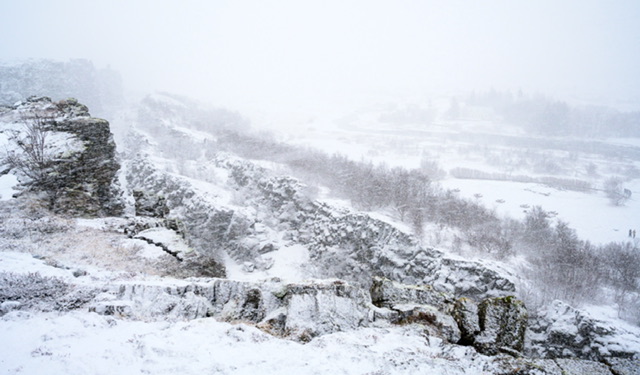
I do really like these ‘snowy’ shots and the opposing contrast of the rocky terrain.
The coach party and us were following the guide as he led us to the steps down to the valley.
Unfortunately the ice was so slippery that we got halfway down and decided to turn back. From what we could see, and observing the guide a bit further down pointing his finger, there wasn’t an awful to see and especially with the snow falling down at pace.
We all assembled back at the coach where it was time to see a Geysir at Strokkur.
Strokkur Geyser
Strokkur is found in the Geysir Geothermal Area, named after the Great Geysir, which lent its name to all others across the world. It is the greatest active geyser on site.
Strokkur erupts more regularly than Geysir ever did, blasting water to heights of around fifteen to twenty metres every five to ten minutes, although it is known to reach up to forty metres.
Our visit
We arrived at Strokkur to see a large car park, visitor centre, shop and large café/restaurant signifying a popular tourist spot.
Our guide briefed us and we followed him across the road and over to the area where Strokkur can be seen.
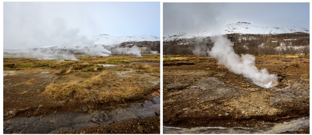
There’s a path to walk up towards Strokkur and plenty of small hot spring holes bubbling away with steam emerging.
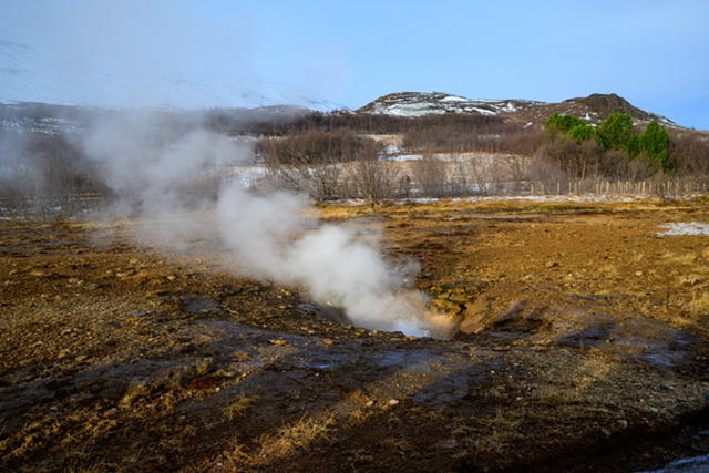
Every few minutes we could hear shouts and screams and the ‘whoosh’ of Strokkur firing up so it was obvious where to go.
I first grabbed a shot side on and just pressed the shutter as it fired up.
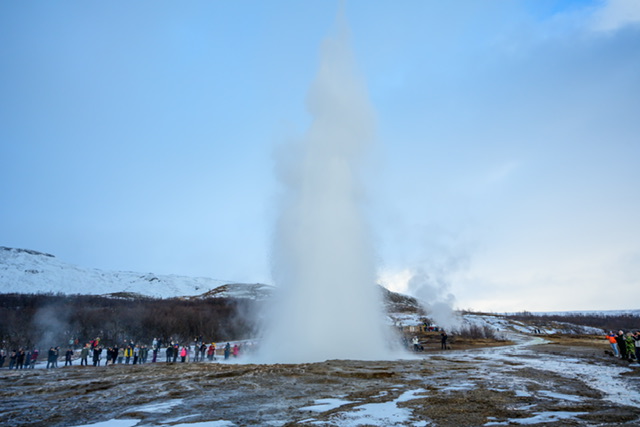
I then took more time to judge the timing of it. We were told it was erupting every four minutes but I just got ready with my finger on the shutter button.
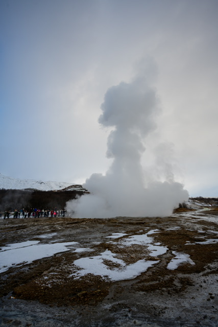
We moved round to get a view from a different position.
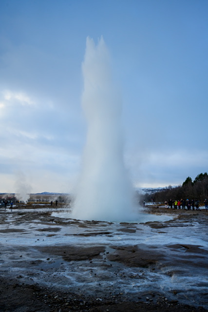
We had grabbed photos and videos as well as just watching it camera-free, and time was ticking so we wandered back to the visitor centre for lunch and a comfort break before getting back on the coach.
Along the path back, I grabbed a couple more shots of the smaller bubbling hot water springs.
We were now heading to our third and final location, Gullfoss waterfall.
Gullfoss Falls
About Gullfoss
Gullfoss (“Golden Falls”; ⓘ [ˈkʏtl̥ˌfɔsː]) is a waterfall located in the canyon of the Hvítá river in southwest Iceland.
Gullfoss is one of the most popular tourist attractions in Iceland. Together with Þingvellir and the geysers of Haukadalur, Gullfoss forms part of the Golden Circle, a popular day excursion for tourists in Iceland.
The Hvítá river flows southward, and about a kilometre above the falls it turns sharply to the west and flows down into a wide curved three-step “staircase” and then abruptly plunges in two stages (11 metres or 36 feet, and 21 metres or 69 feet) into a crevice 32 metres (105 ft) deep.
The crevice, about 20 metres (66 ft) wide and 2.5 kilometres (1.6 mi) in length, extends perpendicular to the flow of the river. The average amount of water running down the waterfall is 141 cubic metres (5,000 cu ft) per second in the summer and 80 cubic metres (2,800 cu ft) per second in the winter.
Our visit
We arrived at Gullfoss to brighter and sunnier weather with some steps down from the car park to the falls.
Care was still needed though as there was plenty of frozen snow along the way.
At the bottom of the steps were the crowds of people all vying to get a viewpoint of the falls.
I queued patiently and made my move to get a decent spot.
I moved forward at pace into a gap near the railings. A young woman behind me was obviously annoyed at my assertiveness and shoved me in the back. A choice word or two from me and she soon backed off. Patience is a virtue dear!
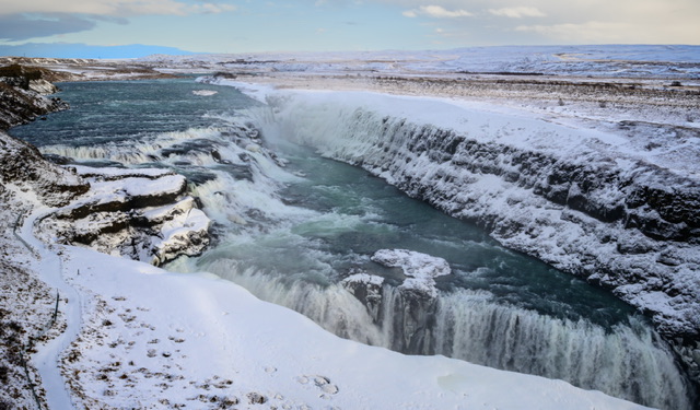
I took a view shots quickly then moved out of the way before the risk of being crushed against the fence got worse.
We walked back along the railings and to a slightly different viewpoint.
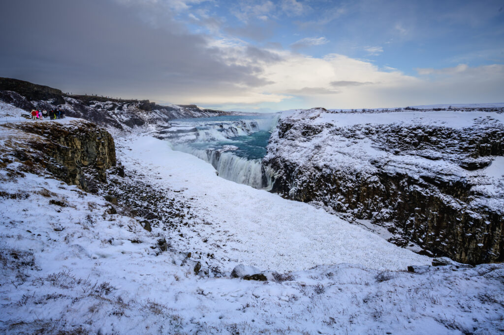
You can see the people at the main viewpoint top-left of the shot above, and also another viewpoint on a different path higher up on left.
This waterfall is spectacular and well worth a visit.
It was time to meet up at the coach and head back to Reykjavik.
The tour guide was very knowledgeable and kept everyone entertained with facts and figures about Iceland, as well as places we passed en-route.
The Golden Circle Tour is excellent and we can see why it’s always recommended and very popular. Three major sights in one day.
We were back at our hotel and just had time for a quick change before heading out to dinner.
We wandered down the road and around a few streets and found a very promising Mexican restaurant. As it turned out, the food was OK but we thought it was basic and quite pricey, and we wished with hindsight that we had returned to the Hard Rock Café.
Day 3 – Blue Lagoon
The Blue Lagoon (Icelandic: Bláa lónið [ˈplauːa ˈlouːnɪθ]) is a geothermal spa in southwestern Iceland. The spa is located in a lava field 5 km (3.1 mi) from Grindavík and in front of Mount Þorbjörn on the Reykjanes Peninsula, in a location favourable for geothermal power, and is supplied by water used in the nearby Svartsengi geothermal power station.
The Blue Lagoon is approximately 20 km (12 mi) from Keflavík International Airport, and is one of the most visited tourist attractions in Iceland.
The water’s milky blue hue is due to its high silica content. The silica forms soft white mud on the bottom of the lake which bathers rub on themselves. The water is also rich in salts and algae.
The water temperature in the bathing and swimming area of the lagoon averages 37–39 °C (99–102 °F).
Our visit
We were able to see parts of Grindavik in the daylight on the way to the lagoon but not the areas we’d passed on the northern lights tour.
On arrival at the lagoon car park, you walk along a path to the main entrance.
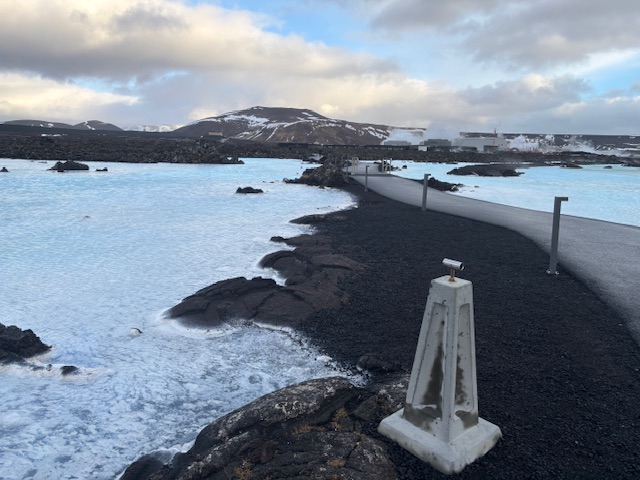
Along the way, you get plenty of views of the blue steaming spa water.
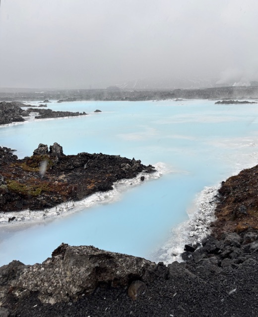
You queue up to get your ticket, or like us if you’ve got tickets in advance you can walk past the queues and straight to the wicket, like a fast pass ticket at theme park.
While we were waiting, a member of staff stood up on a chair and made an announcement. He said that the area was at risk of a volcano eruption and that if we heard a klaxon we were to leave the lagoon, get dressed and make our way to the car park.
He said they had several buses, and several routes out so it would be a safe exit and evacuation.
We went throught the turnstiles have collected our electronic wristband – this records any credit for bath robe, drinks etc.
We the walked to our respective changing rooms via the robe collection point. Guests are instructed to shower nude in the shower cubicles for maximum hygiene.
Kathryn and I met up in our swimwear at the towel collection point, found a place to plonk that and our robes and made our way into the lagoon.
We spent a good couple of hours enjoying the warm spa water, three mud face masks of different types and two drinks. I had a bit of banter with a couple of blokes as we laughed about our appearance in mud face masks.
Afterwards, we got changed and had a cuppa in the café, where I took a phone picture of the view of the lagoon.
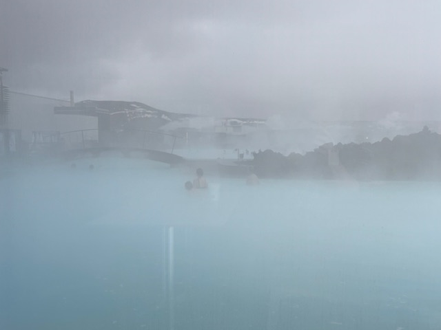
We left the lagoon and headed back to catch the bus back to Reykjavik.
We both really enjoyed the blue lagoon and would recommend it. Like most things in Iceland, it’s not cheap but it is a very enjoyable experience.
For the three day tourist trip, we had visited everything on our to do list and been lucky with the weather and the Aurora showing up. We really enjoyed Iceland and would love to go back one day.
Onwards and upwards…