We had checked out at Plymouth and we were now on our way to Port Isaac in North Cornwall.
Minions (Bodmin Moor) and the Cheesewring
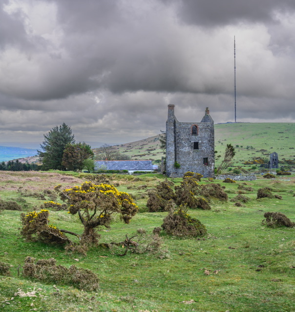
We stopped en route at Minions to have a wander and look at the remains of an area where granite mining was once the main trade in this area.
There was a car park near an old mining house so we parked up and had a wander.
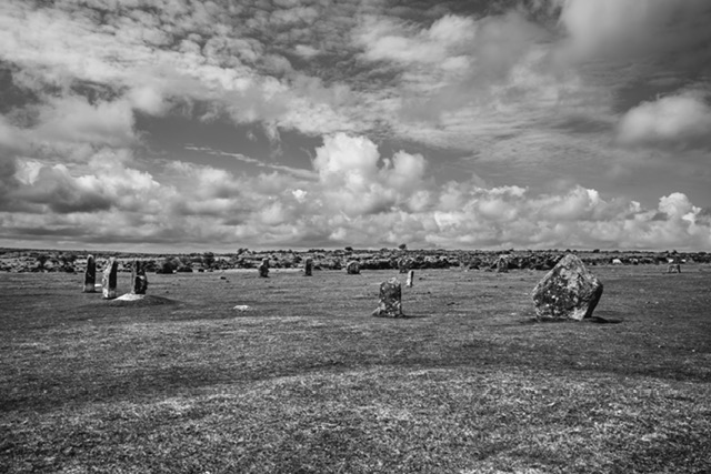
We observed a stone circle which was interesting but there were plenty of large cows looking very settled sitting amongst them so we had a quick peek.
Kathryn spotted some rocks in the distance and wondered if that was a rock known as the Cheesewring.
We decided to walk further and explore the rocks – below are a few images taken en route.

We walked across the moor to where the rocks were and here is the Cheesewring.
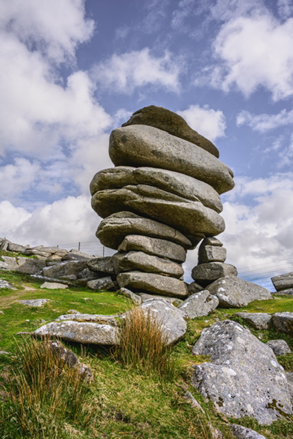
The Cheesewring is a granite tor in Cornwall, England, situated on the eastern flank of Bodmin Moor on Stowe’s Hill in the parish of Linkinhorne approximately one mile northwest of the village of Minions and four miles (6 km) north of Liskeard.
It is a natural geological formation, a rock outcrop of granite slabs formed by weathering. The name derives from the resemblance of the piled slabs to a stack of “cheeses” in a traditional cider press.
Located adjacent to the Cheesewring Quarry (which supplied the granite cladding for the structure of Tower Bridge, London) and surrounded by other granite formations, this landmark was threatened with destruction in the late nineteenth century by the proximity of blasting operations, but was saved as a result of local activism.
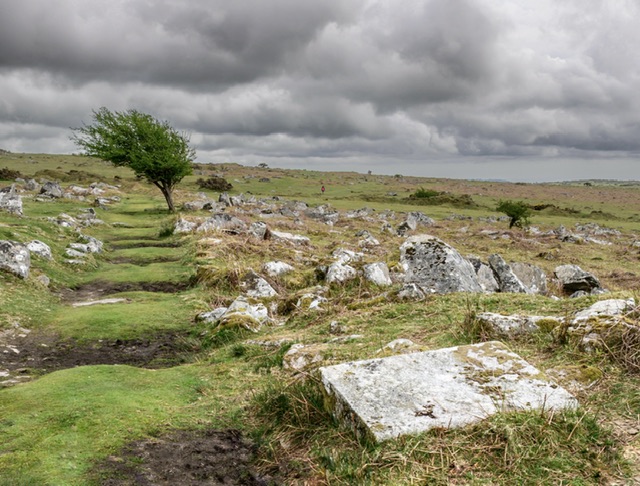
We had a wander around and were enjoying this location – it reminded me of the Norber Erratics in Yorkshire.
As we walked back, I liked this tree which has a shape that makes it look like the wind has blown it to one side. It’s one of my favourite captures.
We wandered back to the car and made our way onwards to Port Isaac.
Port Isaac
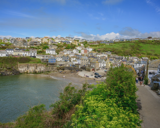
Our first day had to be a wander round Port Isaac.
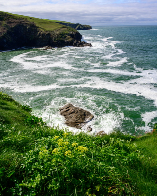
We walked around the clifftop and the views of the picturesque coastline were stunning.
I had my smaller camera and was shooting handheld with some magnetic filters if needed. It as bright and sunny so it was quite useful to be able to deploy a polariser or an ND filter.
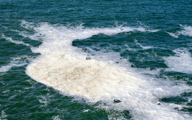
We had noticed some large swirls of sea water but were unsure what causes them.
We observed some fulmars admirably trying to land on their nests on the clifftop in the blustery wind.

As we wandered along the clifftop path, I tried various compositions and aspect ratios to capture the coastline, cliffs, swirling water down below, and the pretty flowers.
As we arrived in the harbour village, we enjoyed wandering around the narrow streets.
Walking up a hill on the other side of the harbour, we could see lots of signs advertising Doc Marten tours. Port Isaac is the location of the TV series starring Martin Clunes. Lots on me! I think I watched it once or twice a long time ago.
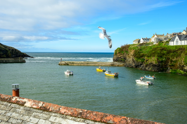
Anyway, there were a few people taking pictures of the house where the fictional Doctor lives whereas I was more interesting in a shot of the harbour.
I thought I would try and get a shot looking out from the side of the harbour, and try and deliberately get a seagull in the shot.
We walked back to the village and up some steep slopes to get back to our flat.
We had seen a few ‘Chelsea Tractors’ driving their vehicles through incredibly narrow streets.
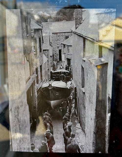
In a shop window, I saw this picture of men trying to get a lifeboat through one of the narrow lanes.
And that was our Port Isaac wandering around day. For the next day or three, we would drive out to other locations to explore more.
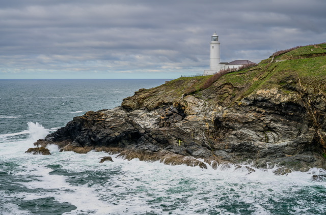
Trevose Head
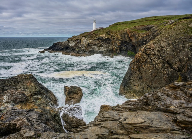
We drove to Trevose Head, a recommended destination from the Fotovue book as it has coastal scenes and a lighthouse.
The actual clifftop here is Dinas Head.
I was really enjoying grabbing some shots here and trying to get movement in the water while shooting handheld.
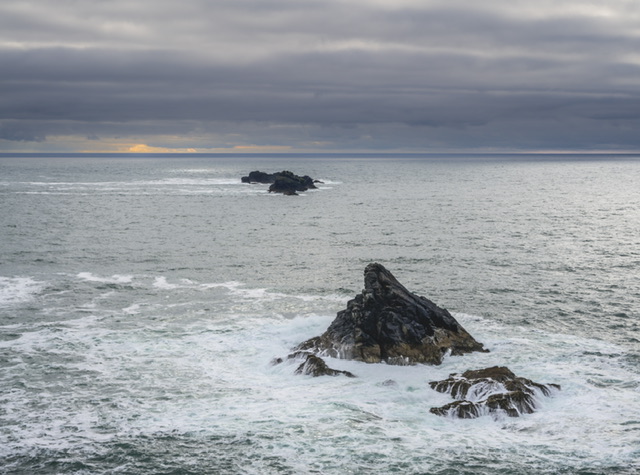
We walked up to the end of the cliff and I tried to get a half-decent shot of these rocks.
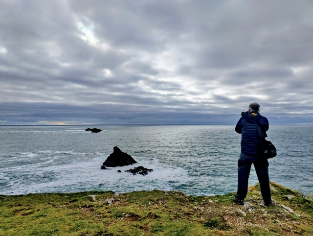
Kathryn got an action shot of me taking the above image.
Kathryn had walked back up towards the car so I walked back too and grabbed a few more images of the cove and lighthouse.
I wandered over to the other side and got a shot of the coastline.
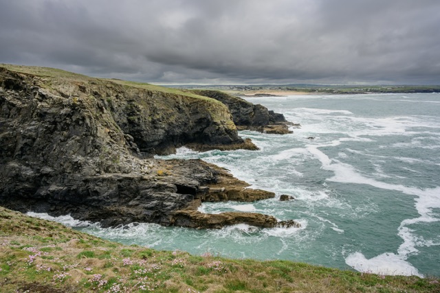
We then walked further along the path to explore a bit more.
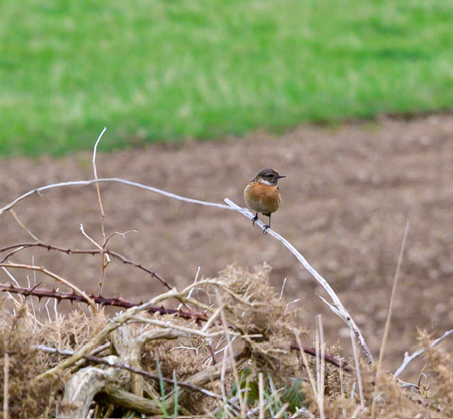
We were quite late getting out so the early evening light was starting to fade so we didn’t have time to go too far.
I grabbed a shot of this stonechat happily sitting there watching me from a distance.
We walked back to the car and very much enjoyed visiting this location.
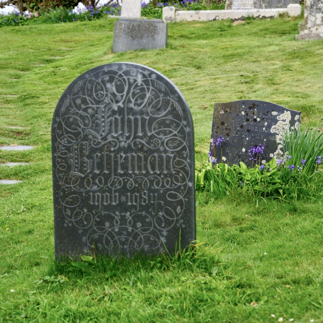
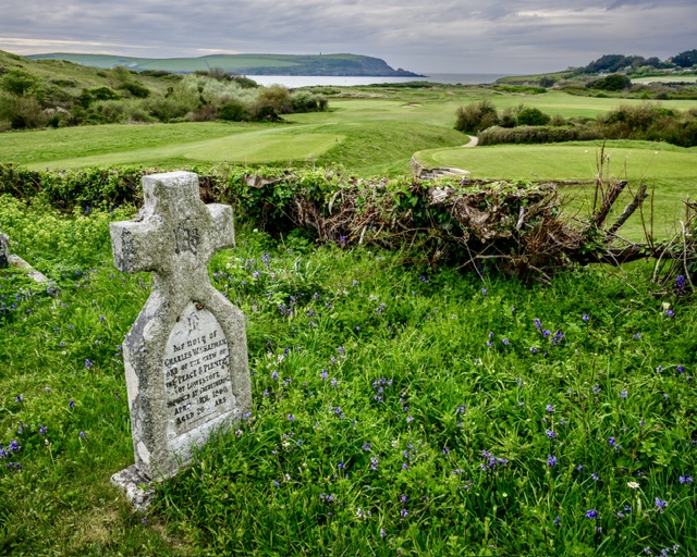
St Enodoc Church
Kathryn had this church on her visit list so we parked nearby and walked through a small patch of woodland and along a path in the middle of a golf course to get to it.
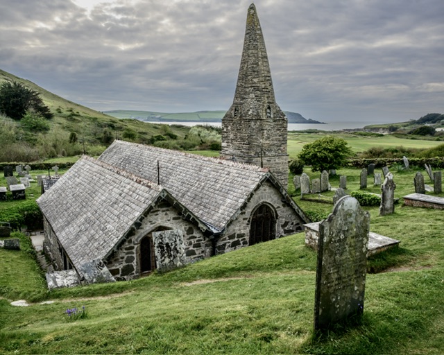
It’s at this church where you can see the resting place of Sir John Betjeman.
Sir John Betjeman, CBE 28 August 1906 – 19 May 1984) was an English poet, writer, and broadcaster. He was Poet Laureate from 1972 until his death.
For the last decade of his life, Betjeman suffered increasingly from Parkinson’s disease. He died at his home in Trebetherick, Cornwall, on 19 May 1984, aged 77, and is buried nearby at St Enodoc’s Church.
I thought the view from the church across the golf course and out to the coast was really nice and had to be captured.
We walked back to the car, and travelled onwards to The Rumps.
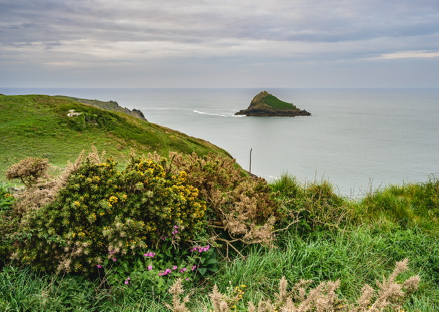
The Rumps
We were heading to another recommended location in the Fotovue book, The Rumps.
We were a lot later getting here than we had hoped but were determined to explore. Parking at the NT car park, we checked the map to understand the path to the coastal views and off we went.
It wasn’t long before we were met with spectacular views.

We wanted to walk further and particularly to the end as seen in the above image, but it was late and we were a little worried about being locked in the car park.
We checked the map and saw that we could walk back on a circular path so we didn’t exactly that.
Some of the paths were perilously close to a very steep part of the cliff with no fence. I would peer over to take a look but Kathryn didn’t fancy it.
We really enjoyed this location and were annoyed with ourselves for not getting here earlier – we would definitely return here when next in Cornwall.
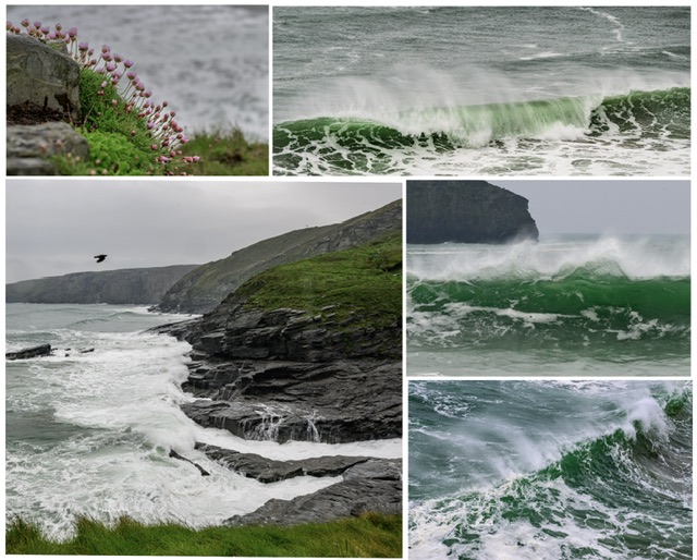
Trebarwith Strand
We had been having very favourable weather albeit changeable. It had been largely sunny and cloudy but today the forecast promised rain, and that’s what we got.
We chose Trebarwith Strand to visit.
Trebarwith Strand (Cornish: Trebervedh Sian; locally sometimes shortened to The Strand) is a section of coastline located near the coastal settlement of Trebarwith on the north coast of Cornwall, Britain, UK, 2+1⁄2 miles (4.0 km) south of Tintagel.
It has 800m of sandy beach contained by cliffs in which natural caves are found. The beach can only be accessed at low tide.
The strand was once used to land ships to export slate from the nearby quarries while sand from the beach was used for agricultural purposes.
The view from the beach is dominated by rocks 300m offshore known as Gull Rock or Otterham Rocks
When we parked up, it was definitely weather for the full waterproof clothing.
As we walked down the road, I could see dramatic waves crashing into the rocks and I noticed the spray that Atlantic waves create that I do not observe with East Anglian North Sea waves.
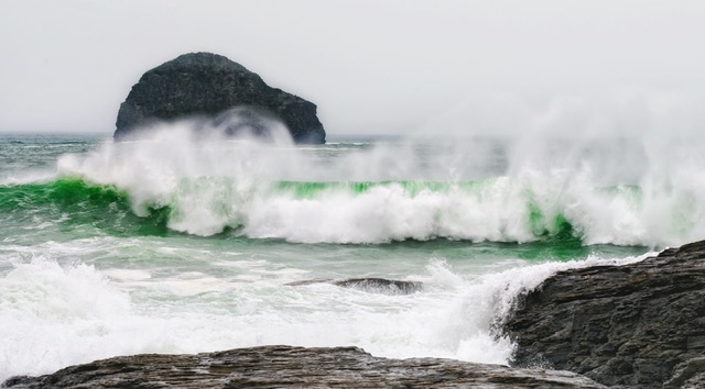
I was addicted to grabbing shots of the waves and I was also experimenting with different aspect ratios, compositions, and shutter speeds.
Below is a montage of some of the shots I took.
The rain was pelting down so we took cover in the nearby pub and decided to have a meal there which was really nice.
I did a few more shots afterwards but the light was worse now and the rain showers heavier so we headed back to our accommodation where we needed to pack.
We would be leaving tomorrow for St. Ives in South Cornwall.
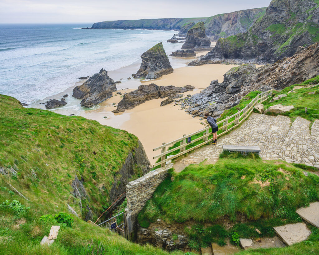
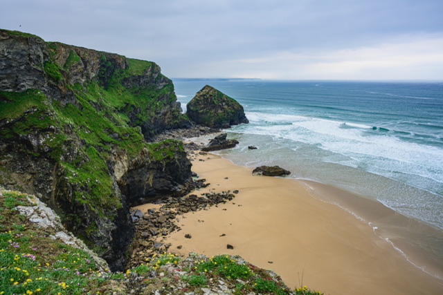
Bedruthan Steps
As we left Port Isaac and headed south to St Ives and decided to call in at another target location Bedruthan Steps.
As the name implies, at this coastal location there are lots of steps down to an amazing beach and coastline. However, a storm in 2020 damaged the cliff and steps which had to be closed off for safety reasons.
I took the image below where you can see the steps and the fence preventing folks walking down.
As we walked around, I took a picture from the clifftop higher up looking left.
We had lunch in the NT café and I had the most amazing sausage and chutney ciabatta roll which made me wanted to eat it again. I’m drooling writing this blog just thinking about it.
We hopped in the car and made our way to St. Ives.
Onwards and upwards…