The meaning of GEEZER is an odd, eccentric, or unreasonable person (usually a man); especially : an old man. (Merriam-Webster).
A fellow photographer (Pat) and I spent two days in the Peak District to visit some pre-chosen locations to shoot.
This is an account of those two whirlwind days.
Day 1
Target locations were Chrome Hill, Hope Cement Works, and Magpie Mine.
A departure time of 06:15 from Norwich, and we were at our first location mid-late morning.
Our information was mostly from the excellent Fotovue Peak District book.
Chrome Hill
We parked in a nearby village, had a quick something to eat and a coffee and got suited and booted to set off.
Following the instructions from the book, we made our way to a public footpath beside a former pub, across two very boggy fields to a hillside where we could see Parkhouse Hill and a glimpse of Chrome Hill behind it.

We walked onwards to Parkhouse Hill and began our ascent with some challenging steep sections.
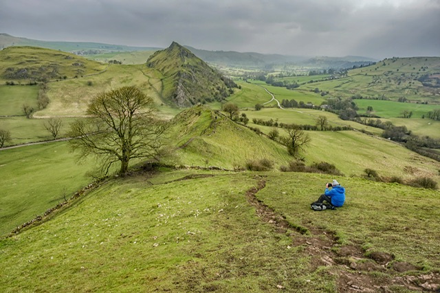
We arrived at the summit and stopped to take some photos.
There were some fantastic views from this vantage point, and we greeted and chatted to a few folks passing us on the ridge.
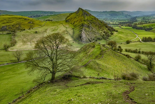
The views all around were stunning but you’ve got to grab a shot of Chrome Hill ahead of you.

Turning around, there was a nice scene with the sun rays showing through the clouds.

Pat lost his camera bag cover as the wind blew it off the side of the hill – we could see it over the side but decided against trying to retrieve it.
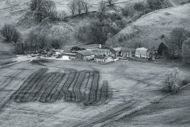
I took the following shot as I liked the patterns in the field.
We made our way down the other side which was quite a challenge. At one point, I was scrambling down the side of this hill butt first as there were few places to get my foot anywhere near fully in place to just step down.
I had thought my walking poles would’ve been really useful but hadn’t foreseen this to be such a trek, so never gave them a thought.
We were about to descend via the next half of the hill but stopped and spotted a easy looking grassy path down the side of the hill which would mean an easier stroll to the bottom.
When we got to the bottom, Pat discovered his camera bag cover sitting there on the grass, like it had parachuted down and was waiting for him.
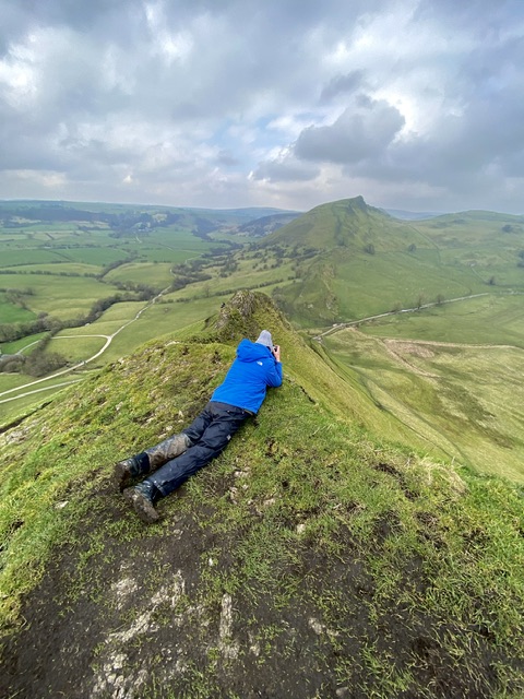
We crossed the road and made our way up the famous Chrome Hill, and the view looking back was impressive – picture below is Pat focusing in on the tree.
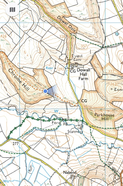
The OS map below shows approximately where we were…
I grabbed a shot from a slightly higher viewpoint.
I converted a similar capture to mono which I quite like.

We decided to take a closer look at some trees just down the path and to the left of this tree.
As we got closer to the tree in the scene above, it had to be captured close-up.

As we wandered down the side of Chrome Hill, we grabbed some shots of various trees – the one below was interesting trying to get the old wall as a leading line.

I would have preferred the top of the tree not to be as it is here but lower or higher compositions were either cutting out the wall or impossible to do.
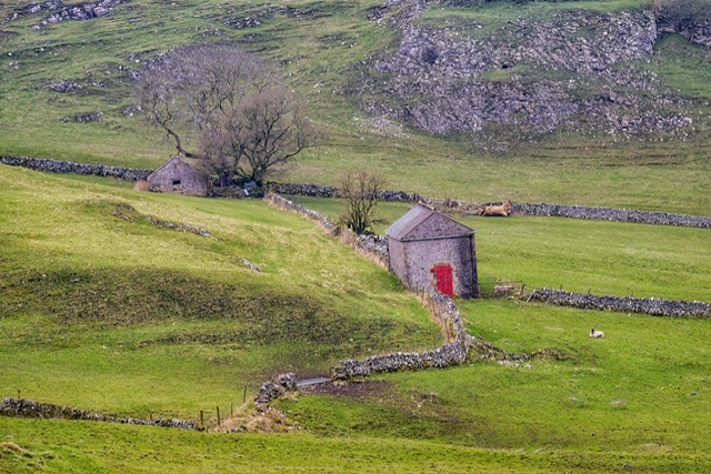
Across the field to our right was an interesting outbuilding with a red door. Pat thought this was an interesting scene and encouraged me to grab it.
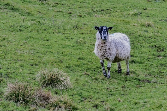
This sheep was giving me a stare!
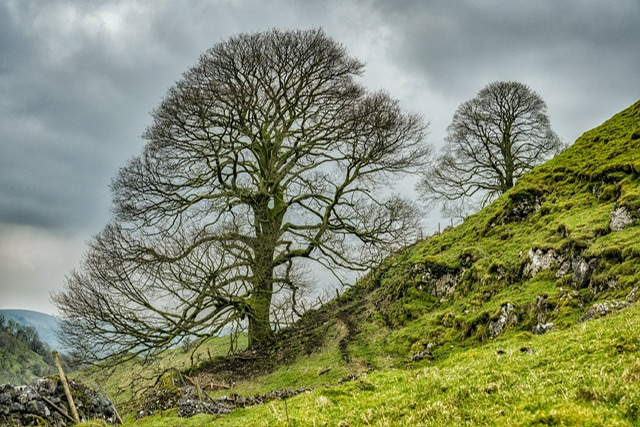
We decided to head back and I grabbed a shot of these two lovely trees.
We were ready to head back to the car and made our way down from Chrome Hill.
We decided to head back via the road and en route, we passed this old phone box.

We walked back to the hill from where we came, up that and then across the two fields we started at and back to the car.
Sandwich, coffee and something sweet and we were ready to move on to our next location.
As we drove out of the village, we realised that instead of hiking across the muddy fields, and over the ridge of Parkhouse Hill, we could’ve walked down the road to the middle of Parkhouse Hill and Chrome Hill.
A fellow club member had mentioned walking down a track, and choosing left or right for the desired hill – that all made sense now we had got our bearings.
Never mind, it had been an adventure, and we shall know for next time!
Hope Cement Works
Our next target was a cement works in the Hope Valley.
I was aware of this structure from seeing it at a distance years ago from the ridge of Mam Tor.
About Hope Cement Works
Hope Cement Works, is a cement plant located near to the village of Hope in Derbyshire, England. The plant is mostly self-contained with its own shale and limestone quarries adjacent, with only fuel and small amounts of additives needing to be brought in.
The site is located inside the Peak District National Park, and so is subject to tighter planning restrictions than other cement plants in the United Kingdom. It is now the largest cement plant in the United Kingdom (in terms of tonnages of cement), and is also one of the largest emitters of CO2 within the national park.
The plant started its first full year of production in 1929, and was initially producing 50,000 tonnes (55,000 tons) of cement per year.
The plant was located at Hope, because it is at the edge of where carboniferous limestone of the Monsal Dale Group, meets shale (Edale Shale), the two main components of finished cement
Since 1951, when the Peak District National Park was created, most of the outbound traffic from the plant has been exported by rail. This requirement is still in effect in the 21st century, with the authorities continuing their desire for rail to manage the lion’s share of the traffic to and from the plant.
Around 66% of the works output (1,000,000 tonnes (1,100,000 tons)) is transported from the site via the railway link connecting to the Hope Valley Line.
A study in 2020 determined that the plant supported a total of 270 jobs and brought over £60 million into the local economy.
The Shoot
We couldn’t locate the spot mentioned in the Fotovue book, so asked a local for directions and then followed the road high up and in a circular route.
We parked on the side of the road and could see the factory with hills in the background. There were periods where the sun shone on some of the hills or the factory so we were hopeful of getting some decent shots.
A wander over the road and through the gate took us right to the viewpoint.
It was bitterly cold with a biting wind cutting into us and quite blustery at times, and some shots were too blurry when the gusts were strong enough to rock the tripod.
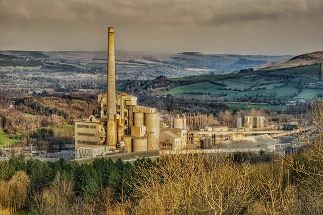
In moments when the wind appeared to die down, a long exposure was called for, so I grabbed this shot below:

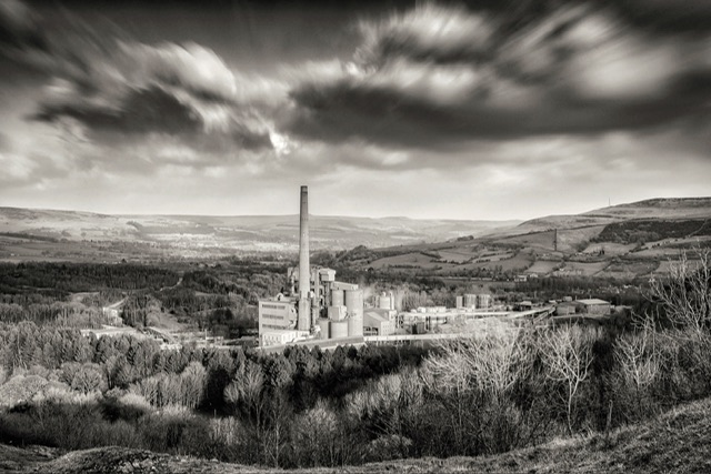
An similar shot is below converted to mono:
We took a few shots and decided it was time to make our way to our third and final target location for today.
Magpie Mine
We got to the postcode in the book, parked the car in a lay-by at side of the road, then made our way across two or three fields before climbing carefully over a low wire netting fence.
About Magpie Mine
Magpie Mine is a well-preserved disused lead mine near the village of Sheldon in Derbyshire, England, in the parish of Ashford in the Water. The walled enclosure of five lead mines (Magpie Mine, Dirty Red Soil, Great Red Soil, Maypit and Horsesteps) is a protected Scheduled Monument.
Mid-Derbyshire has a history of industrial lead mining going back to Roman times. Lead mining at this site goes back to at least the 17th century.
The Shuttlebark vein of lead ore was officially opened in 1682. Magpie Mine is recorded back to 1740. After over 200 years of operation, Magpie Mine closed in 1958 and was the last working lead mine in Derbyshire.
The Shoot
As we approached the mine and the structures, I remembered this from when I visited back in 2016, although that was daytime and from what I can recall, walking from the opposite direction.
It was very blustery now with the winds getting worse as the evening drew to a close.
The other challenge was that we were losing the light rapidly so that, combined with the winds made for really challenging conditions.
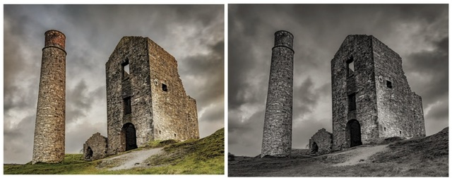
Below is probably my best shot I could get, colour and mono conversion side-by-side:
I tried some long exposures but either the winds shook my tripod, or the light was so poor the images were so dark and noisy, I wasn’t able to recover them to a suitable quality.
We called a wrap, packed up and made our way across the fields back to the car, torches on.
At the Travelodge, we dumped our stuff, and headed straight to the pub next door. We had talked earlier in the day about steak and ale pie being a good feed after a strenuous trek, and there it was on the menu.
Two pints of Guinness, and the most amazing steak and ale pie (no soggy pie bottom which is my pet hate!), mash, veg and gravy, and it certainly hit the spot!
Anyone near to our table must’ve wondered what the “hmm’s and ah’s” were all about but the combination of being knackered, content, and hungry is what made this nosh up amazing!
I should’ve taken a picture of the grub with my phone, especially since I’ve been dreaming about it since, but I didn’t think to do it, and the hands were full shovelling the Guinness and food down.
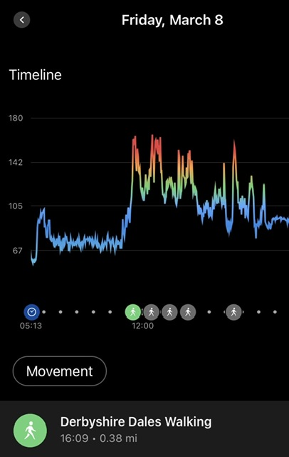
Below is what my watch claimed was my heart rate for the day…
We agreed that with rain forecast for the morning, and how knackered we were, we would meet in reception at a very sociable 08:15.
Day two beckoned, but would it be as good as day one?
Read Day 2 to find out.
Onwards and upwards…